Is The Icefields Parkway Difficult To Drive?
An honest assessment of the Icefields Parkway between Jasper and Lake Louise: grades, winter rules, services, cell coverage and where the road is genuinely hard.
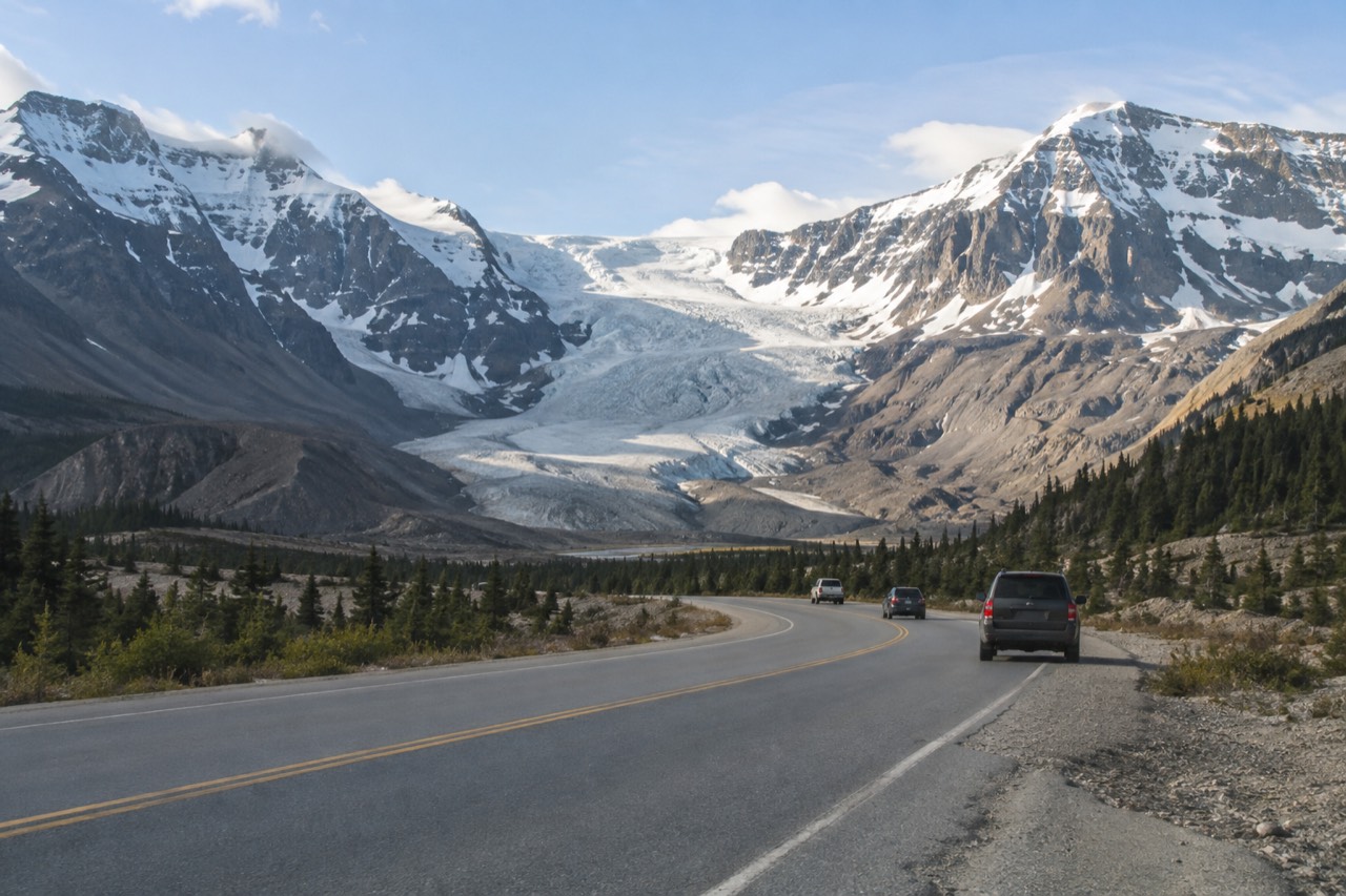
Is The Icefields Parkway Difficult To Drive?
For a confident highway driver in summer, no: the Icefields Parkway is a well-built two-lane road, 232 km between Lake Louise and the Jasper townsite, with a 90 km/h maximum speed limit and paved surface throughout. It becomes genuinely difficult in winter, when snow tires or chains are legally required, the road is not salted, and there are no services and no cell coverage anywhere along it.
The honest answer depends almost entirely on the season and on how you feel about mountain grades. In July, thousands of rental cars, campers and family sedans complete the drive without incident, stopping at Athabasca Falls, Sunwapta Falls and the Columbia Icefield along the way. The road is wide, the sightlines are long by mountain standards, and Parks Canada maintains it daily during working hours. What catches people out is not the road itself but its emptiness: 232 km with no cell coverage, and in winter no fuel, no food and no open washrooms anywhere en route. That is a different kind of difficulty than a technical driving challenge, and it is the one that actually catches unprepared travellers.
Parks Canada publishes a dedicated winter driving page for the parkway rather than a seasonal closure notice, which tells you the official position in one line: this road is meant to be driven all year, but winter driving on it is a real undertaking with its own rules. The authority on day-to-day conditions is 511 Alberta, and Parks Canada explicitly warns that navigation apps and web mapping platforms are not always accurate for Jasper National Park, so check the road report rather than trusting a phone.
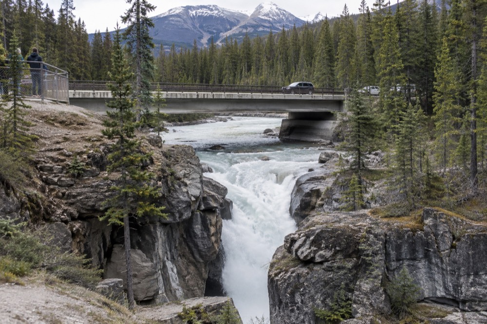
For a nervous driver, the practical question is not whether the road is possible but whether it is pleasant, and that is where a guided departure earns its keep. A driver-guide who runs this highway weekly handles the grades, the wildlife jams and the fuel planning while you watch out the window. The three options below cover the two most common ways to hand over the wheel, plus the one stop most parkway drivers want at the far end.
What actually makes the parkway hard?
Three things: long steep grades of 8 to 11 percent near Bow Lake and Sunwapta Pass, a total absence of services in winter, and wildlife on the road at any hour. None of these makes the parkway dangerous for a prepared driver, but together they mean you cannot treat it like a highway commute, and you should not start it on an empty tank.
The grades are the part that surprises people. The climb and descent around Sunwapta Pass in the Columbia Icefield area, and the pitches near Bow Lake further south, run between 8 and 11 percent, which is steep enough that a loaded camper or a rental RV slows dramatically uphill and gathers speed quickly downhill. Use a low gear on the descents rather than riding the brakes. The maximum speed limit inside the national parks is 90 km/h, and it drops lower in places for wildlife, so the road never invites the kind of cruising speed that a prairie highway does.
Wildlife is the other live variable. Bighorn sheep, mountain goats, coyotes and deer are all commonly sighted along the parkway in winter, and elk and bears use the valley in summer. Roadside wildlife viewing is a restricted activity in Jasper National Park year round: stay in your vehicle, slow down, use hazard lights, pull over only where it is safe, never stop in a driving lane, and move on immediately if a traffic jam develops. A 20 km stretch of the parkway also runs through the winter habitat of the Jasper herd of woodland caribou, a species at risk, which is one reason the road is not treated like a commuter route. A sighting is never a guarantee in either direction; what is guaranteed is that an animal on the road at dusk is the single most common sudden-braking scenario on this drive.
Then there is the emptiness. There is no cell coverage along the parkway; service exists only at each end, in the Jasper townsite and around Lake Louise. In winter there are no services at all along the route, and even in summer the gaps between fuel and food are long enough that you plan them in advance rather than improvise. The distances below are Parks Canada's own figures, and they are worth memorising before you set out, because they define how far you are from help at each stage of the drive.
| Point on the drive | Distance from Jasper | Distance from Lake Louise |
|---|---|---|
| Athabasca Falls | 30 km | 203 km |
| Sunwapta Falls | 54 km | 179 km |
| Icefield Centre | 103 km | 129 km |
| Total parkway length | 232 km | 232 km |
If reading that table makes your shoulders tighten, that is a reasonable signal. A guided tour that includes the parkway's headline stops, like the Jasper to Banff glacier day tour route many travellers ask about, trades a day of white-knuckle descending for a seat with a view.
Is the Icefields Parkway open in winter?
Yes. The Icefields Parkway does not close for the winter. What changes is the legal equipment requirement and the support: from 1 November to 31 March, or any period when the road is covered in snow and ice, your vehicle must have snow tires or chains, and in winter there are no services along the route, no cell coverage, and snow clearing only runs 7 am to 3:30 pm.
This is the single most common misconception about the road, and it is worth being precise. Parks Canada does not publish a seasonal closure date for Highway 93 North, because there isn't one. It publishes a winter driving guide instead, covering tire requirements, fuel planning and what to do if you go off the road. The tire rule is not advisory: snow tires carrying the snowflake or M+S symbol, or chains, are required from 1 November to 31 March, and rental cars from major agencies in Alberta normally come with them, but it is your job to confirm that at the counter.
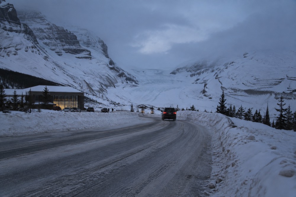
The maintenance window is the detail that changes how you plan a winter day. Snow clearing and road maintenance run 7 am to 3:30 pm. Outside those hours, whatever falls on the road stays on it until morning, and because the parkway is not salted, the surface is often compact snow rather than bare pavement. If a winter storm hits at 4 pm and you are 100 km from either town, you are driving on whatever the storm left, in the dark, with no cell coverage and no one patrolling. Experienced winter drivers leave early, drive the longest legs before mid-afternoon, and treat the 3:30 pm end of maintenance as a hard planning deadline.
The pass point matters more than most visitors expect. A park pass is legally required to be inside Jasper National Park, and Parks Canada states on both of its Icefields Parkway pages that a valid pass is required to drive the road. The daily admission fee is charged per person, $12.25 CAD for an adult, with a Family/Group rate of $24.50 CAD covering up to seven people arriving in one vehicle, and Parks Canada raises these fees annually, so confirm current figures on the official fee page before you go. There is no timed entry, no reservation system and no mandatory shuttle on the parkway or anywhere in Jasper; the pass is the only authorization you need.
What about fuel, food and washrooms along the route?
In summer, services exist at a handful of points along the parkway, but they are sparse and seasonal, and in winter there are none at all. There is no cell coverage anywhere en route, so you cannot rely on searching for the nearest open gas station mid-drive: plan fuel and food before you leave, and treat the Icefield Centre, 103 km south of Jasper, as the main mid-route stop.
The summer pattern is workable. The Icefield Centre sits across from the Athabasca Glacier and holds the Parks Canada information desk and Glacier Gallery, plus food service during the operating season. Saskatchewan River Crossing, south of the icefield on the Banff side, is the other traditional fuel and food stop. But both are seasonal businesses in a road corridor that is empty by design, and neither is a guarantee on any given day, which is why every piece of official advice about this drive starts with fueling at either end.
In winter the answer collapses to zero. Parks Canada is blunt about it: there are no services along the Icefields Parkway in winter. No fuel, no food, no open washrooms. Combined with no cell coverage, that means a winter breakdown is not an inconvenience, it is an overnight situation until someone happens past or you are reported missing. Carry a full tank, blankets, food, water, a physical map and a plan you have told to someone at your destination. This is standard winter mountain driving practice anywhere in Canada, but the parkway's length and emptiness make the consequences of skipping it larger than on a ski-hill access road.
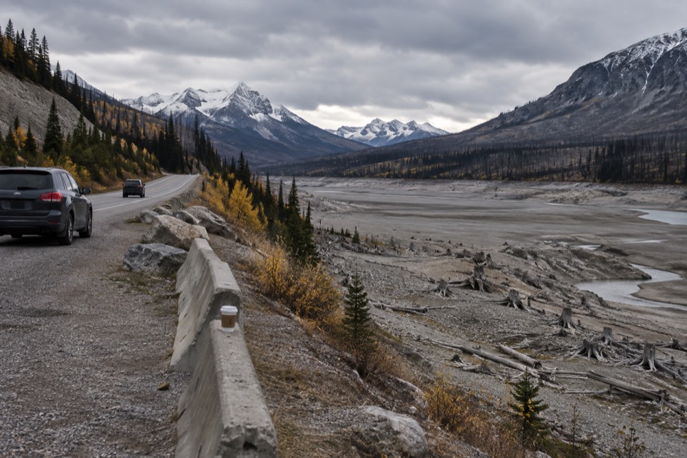
For summer travellers the fuel math is simple: the drive is 232 km end to end, plus however much you add exploring side roads like the 14 km Cavell Road, which is closed for the 2026 season, or the Miette Road. Fill up in Jasper or in Lake Louise, and do not start the drive below half a tank even in July, because the one mid-route station you were counting on can be closed for a mechanical reason with no alternative for 100 km. The same logic applies to food: the Icefield Centre is the reliable mid-drive stop, and its hours are seasonal, so check ahead rather than assuming lunch will appear.
Where are the most difficult sections?
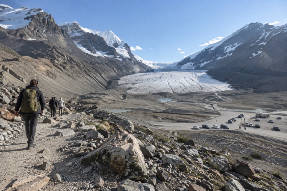
The hardest driving is concentrated in two areas: the long grades of 8 to 11 percent near Bow Lake and on the ascent and descent of Sunwapta Pass in the Columbia Icefield area, roughly the middle third of the route. The Jasper-side third, past Athabasca Falls and Sunwapta Falls, is comparatively gentle valley driving, and the Lake Louise-side third is rolling rather than alpine.
If you want to break the drive into difficulty bands, the geography does it for you. Leaving Jasper southbound, the first hour follows the Athabasca valley: Athabasca Falls at 30 km, Sunwapta Falls at 54 km, wide shoulders, river views, and the kind of road where a nervous passenger relaxes. The middle third is where the road earns its winter tire law: the climb toward the icefield and Sunwapta Pass is sustained, the descents are long enough to overheat careless brakes, and the weather can differ completely from what you left in the valley. The southern third toward Lake Louise passes Bow Lake's grades and then eases into montane forest.
Wildlife concentrates in predictable places too. The Chaba River burn area beyond Sunwapta Falls, the legacy of a 1967 wildfire, is named by Parks Canada as some of the best bear and moose habitat in the park, so that gentle first hour is exactly where you should be scanning the ditches at dawn and dusk. Drive at the speed limit, not above it, and expect that a stopped car ahead means an animal, not a viewpoint.
The other honest note for anyone driving this corridor after the 2024 wildfire: the burn is visible along the Athabasca valley south of town and around the townsite's southwest edge, and regrowth is under way. Parks Canada's own summary is that the majority of Jasper National Park is now open and ready to explore and virtually all of the park's trails have reopened. The parkway itself was never closed by the fire, and the drive remains the same road it always was; check the Parks Canada road restrictions page for any current bulletins before you plan around a specific side road.
When does it make sense to let someone else drive?
If you are uneasy on mountain grades, travelling in winter, driving a large RV, or simply want to look at the scenery instead of the centre line, a guided tour is the better choice: a driver-guide handles the pass, the fuel planning and the wildlife jams, and several Jasper departures cover the parkway's headline stops with hotel pickup and free cancellation.
There is no shame in this calculation, and it is often the difference between a holiday and an endurance test. A traveller who spends the Sunwapta Pass descent gripping the wheel sees none of the icefield that the road exists to serve. The trade is control for attention: you lose the ability to stop for 40 minutes at a roadside pullout, and you gain the ability to actually see the place you drove 232 km to see.
For travellers pairing the parkway with Jasper's other signature water, the wildlife and sightseeing tour with the Maligne cruise is the strongest all-in-one option: 6 hours, hotel pickup, free cancellation, and a route that takes in Patricia Lake, Medicine Lake, Spirit Island and the Whistlers summit, rated 4.8 across 665 reviews.
If your priority is the glacier itself rather than the driving, the small-group Explore Jasper tour with the Maligne Lake cruise runs 6 hours 30 minutes, covers Maligne Canyon's viewpoint area, Medicine Lake and the Athabasca River as well as the lake, and is rated 4.6 across 57 reviews with free cancellation. It suits a visitor who wants the valley's story told without once touching a steering wheel.
For the full picture on planning this corridor, the Banff to Jasper drive guide covers itinerary options, and what to wear on a Jasper glacier tour handles the clothing question that catches out summer visitors at the icefield, where conditions on the ice are winter-like even in July. This site, Jasper National Park Tours, exists to make exactly these calls easier.
The short version, then: the Icefields Parkway is not a difficult road in summer for anyone comfortable on a mountain highway, and it is a serious commitment in winter for anyone. Know which of those two trips you are actually taking, prepare for that one, and the road will feel like what it is, one of the most beautiful drives in North America.
Common questions about driving the Icefields Parkway
Is The Icefields Parkway Difficult To Drive?
In summer, no: it is a paved two-lane highway with a 90 km/h limit, and confident drivers complete it routinely. In winter, yes: snow tires or chains are legally required, the road is not salted, maintenance runs only 7 am to 3:30 pm, and there are no services and no cell coverage along the entire 232 km.
Does the Icefields Parkway close in winter?
No. Parks Canada publishes a winter driving guide for the road, not a closure date. Snow tires or chains are required from 1 November to 31 March, and you must plan for no fuel, food or cell coverage along the route in winter.
Do I need a park pass to drive the Icefields Parkway?
Yes. A valid national parks pass is required to drive the parkway itself, and a pass is legally required to be inside Jasper National Park. The daily fee is charged per person, $12.25 CAD for an adult, with a Family/Group rate of $24.50 CAD covering up to seven people in one vehicle.
Is there cell service on the Icefields Parkway?
No. There is no cell coverage anywhere along the route; service exists only at each end, near the Jasper townsite and around Lake Louise. Plan fuel, food and your schedule before you start, and tell someone at your destination when to expect you.
Where are the steepest parts of the drive?
Long grades of 8 to 11 percent occur near Bow Lake and on the ascent and descent of Sunwapta Pass in the Columbia Icefield area, roughly the middle third of the route. Use a low gear on the descents rather than riding the brakes.
Can I just take a tour instead of driving it myself?
Yes, and it is a common choice for nervous drivers, winter travellers and RV drivers. Several Jasper departures cover the parkway's headline stops with a driver-guide, and options with hotel pickup and free cancellation are listed above.